Jordan


The only functional Middle Eastern country?
OK, Turkey is functional too, but it sort-of thinks of itself as almost, kinda semi-European.
The entry into Jordan at Aqaba's ferry terminal was smooth and untroubled - in particular contrast to the delayed and disorganised exit from Egypt at Nuweiba. An exchange of baksheesh between our greeter and a customs official and only a sample of our luggage was put through formalities.
Aqaba in daylight is neat and clean. Locals shouted welcomes and waved from passing cars, a shisha and a sweet Egyptian tea at outside cafes as short breaks to wandering the town was a good introduction to a more relaxed vibe in Jordan, which unlike Egypt and Syria did not break out in riots and civil war after our departure.
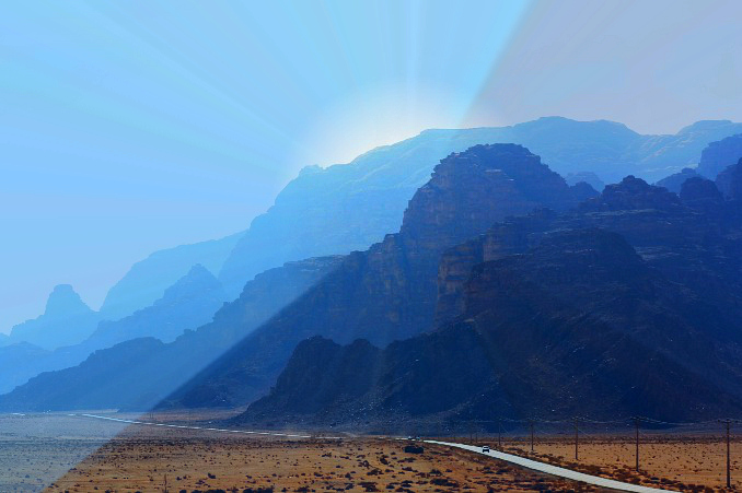
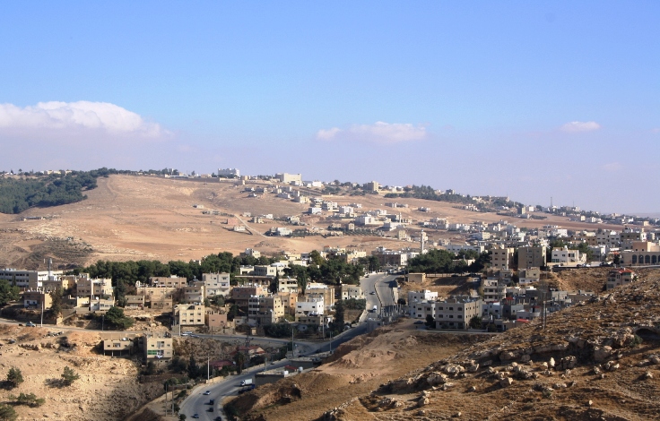
The road into Wadi Rum - a side road into the desert from the four lane, dual carriage freeway that connects Aqaba and Amman. The well constructed freeway featured speed humps along its length - an innovative and bumpy concept for a high speed inter-city route.
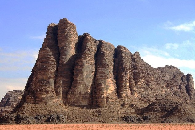
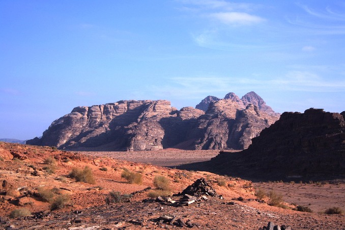
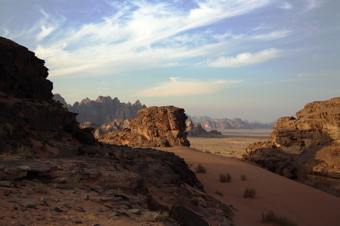
Wadi Rum
Bucket List Rating 
Bedouins, Lawrence of Arabia and lots of special desert scenery
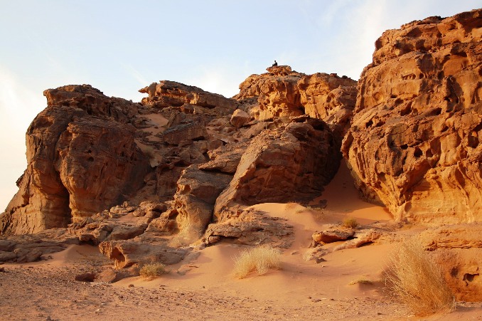
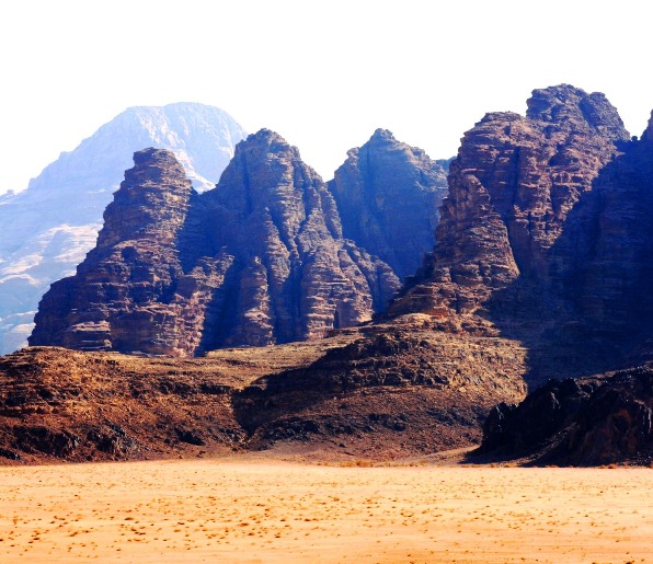
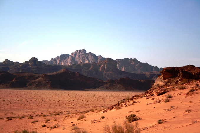
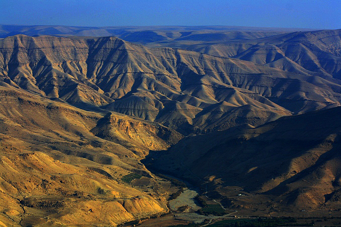
720 square kilometers of spectacular weathered sandstone and granite formations emerging from the sand forming a huge maze of canyons and valleys. Ancient rock drawings have been etched by desert dwellers over millennia. The Bedouin tribes still living here conserve the environment and run the tourist operations as an eco-friendly means of income. Their large goat-hair tents serve as their own accommodation where they welcome off-road tourists and as tourist-dedicated stop-overs spread through the Rum.
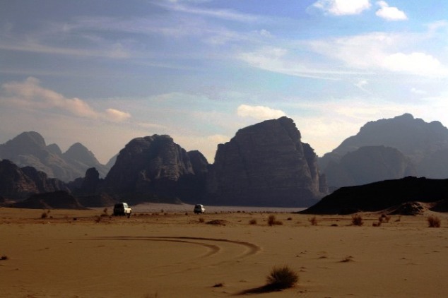
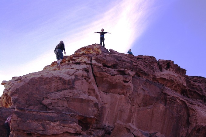
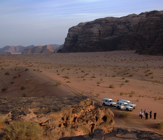
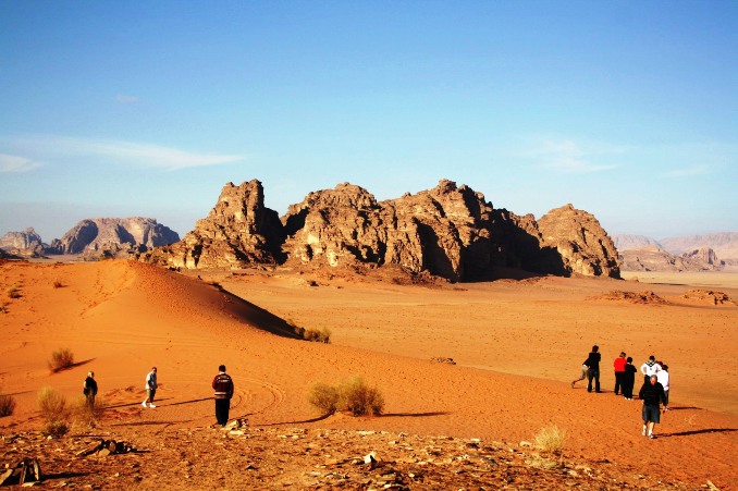
An off-road exploration in hired 4WDs with local Bedouin drivers.
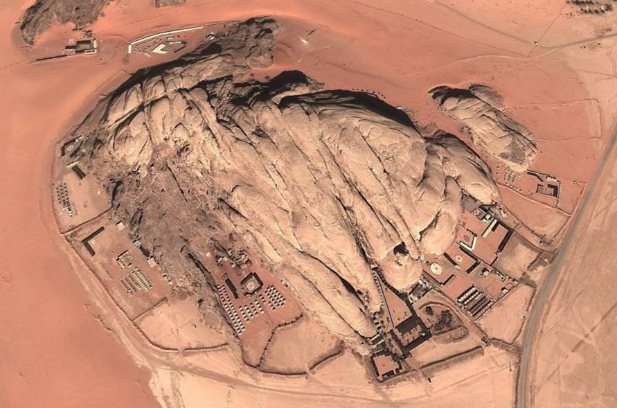
Below: Captains Camp in Wadi Rum from Google Earth. Captain's Camp is bottom centre. Look closely and there are two parrallel lines to be seen leading from the entrance to the Tener's tent at the back, tracking Bruce's progress through the sand with his wheelie bag.
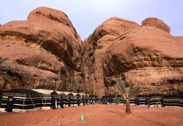
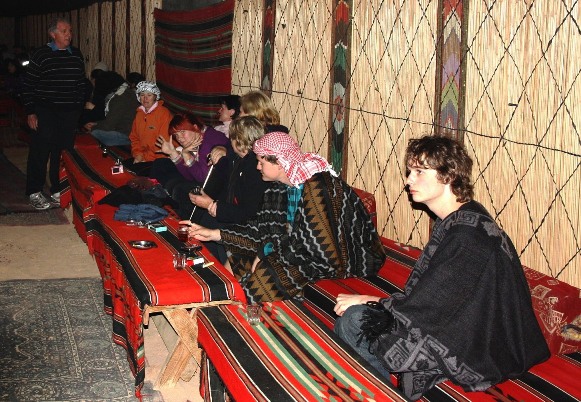
The rooms at Captain's Camp are mini, woollen Bedouin tents. The Tener's tent, on the far-end on the left, smelled like urine. The desert nights are freezing, the ablutions tent was too far to stumble in the pitch blackness, and I was really busting.
The evening spent around warm fires with tea and shishas in the big tent across the front of the camp. Engaged some friendly Yanks in conversation - god-botherers on a quick tour before leaving their daughter to preach Jesus to the locals. Not too sure how such proselytizing would go down with the locals - as hospitable as they were, folks in this part of the world take their Islam pretty full-on.
Petra
Bucket List Rating
How to carve a really, really elaborate cave
Petra is the OMG experience of Jordan. No superlative will do it justice.
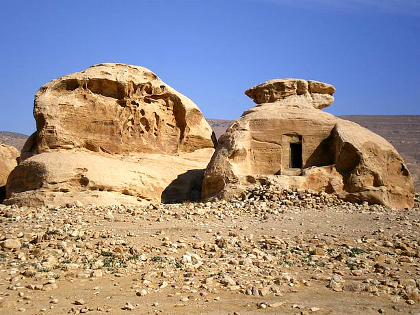
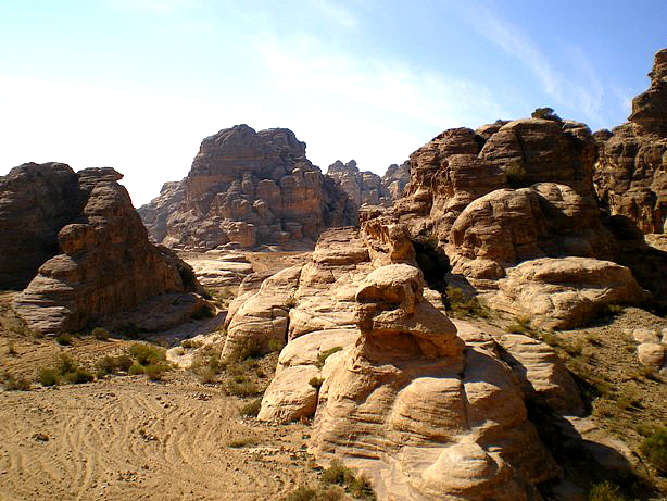
The surrounding landscape is a warren of eroded corridors between sandstone outcrops. Fingers of fields are cultivated by Bedouins or used to graze sheep and goats. Many of the rock formations have had dwellings carved into them as man-made caves, seemingly now unoccupied. The Bedouins prefer their tents.
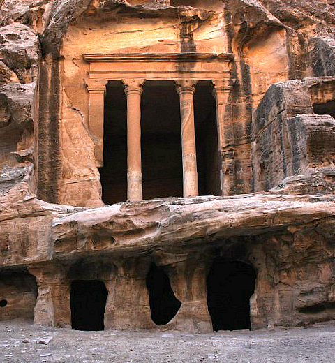
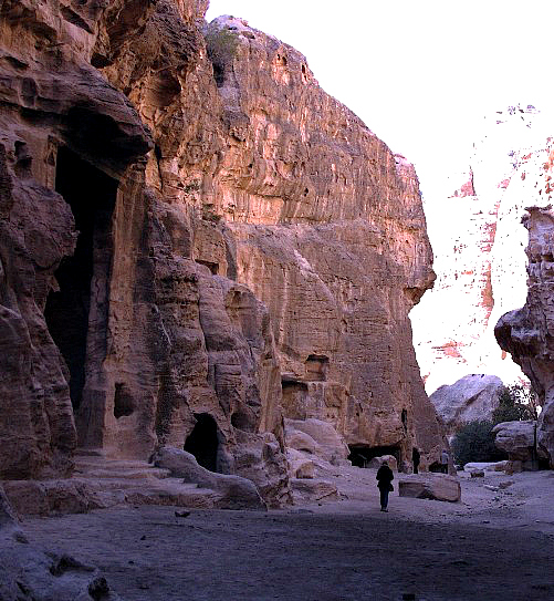
Above. Siq al-Barid (Little Petra), separated by a few kilometres from Petra. It's best to visit here first. Impressive in its own right, it's a great teaser for the main site. Your expectations for Petra itself are set for something similar, which then heightens the impact of the grander big brother.
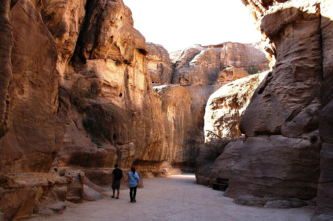
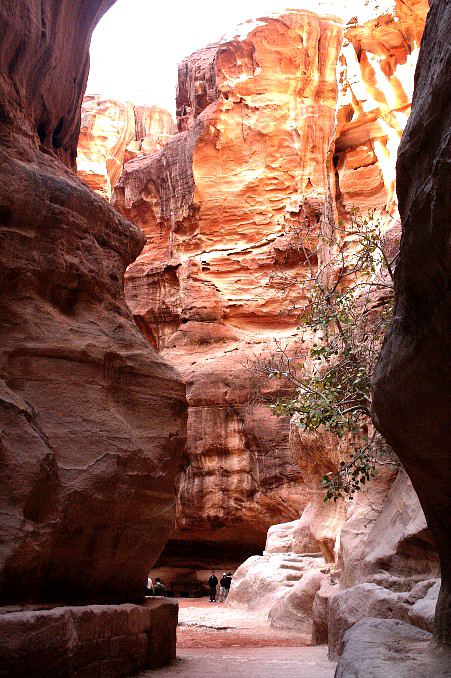
Below. The stroll down the kilometre long siq to Petra. A deep, geological split smoothed by water erosion the siq is no wider than 3 metres at some points with walls up to 200 metres high.
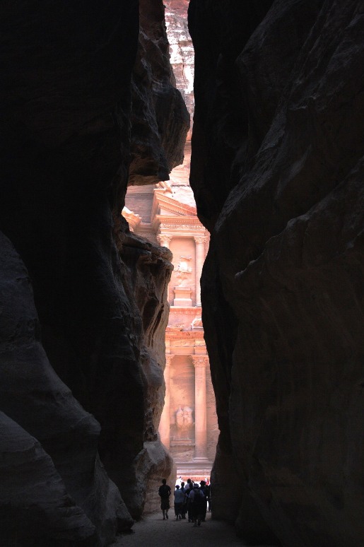
The end of the siq reveals this:
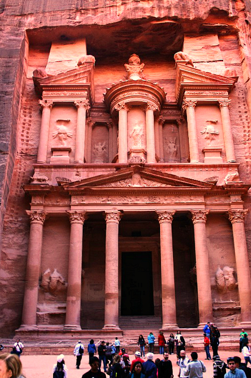
The Treasury. More likely built as a tomb and/or temple, it got its popular name from the belief that pirates had hidden treasure in the tholos (stone urn) which stands in the centre of the second level. In an attempt to release the suspected treasure, the Bedouins periodically fired guns at it — the bullet holes are clearly visible.
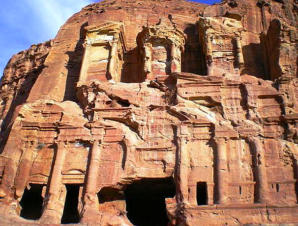
Monuments along the Street Of Facades, below. Round a bend at the Treasury and the siq opens up and leads down to the complex of tombs, temples and simple, cave-like dwellings carved into the rock faces.
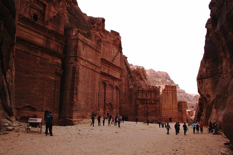
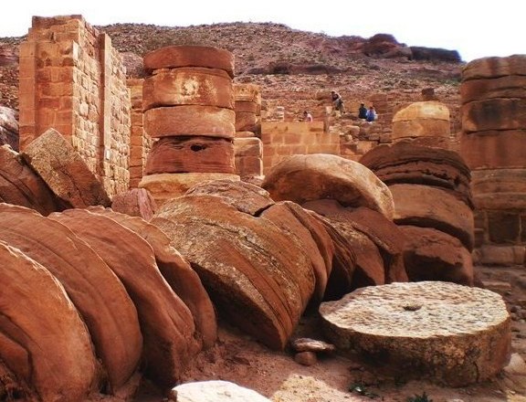
Remnants of Roman era free standing structures - a bit more vulnerable to earthquakes than the rock-carved temples and tombs.
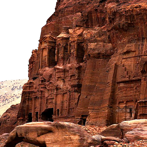
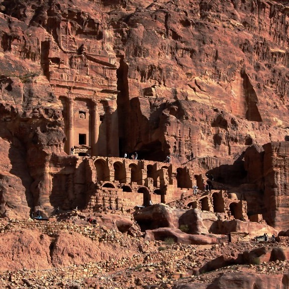
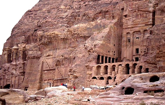
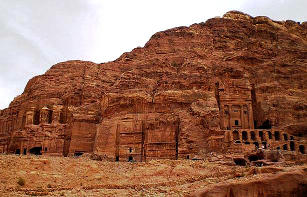
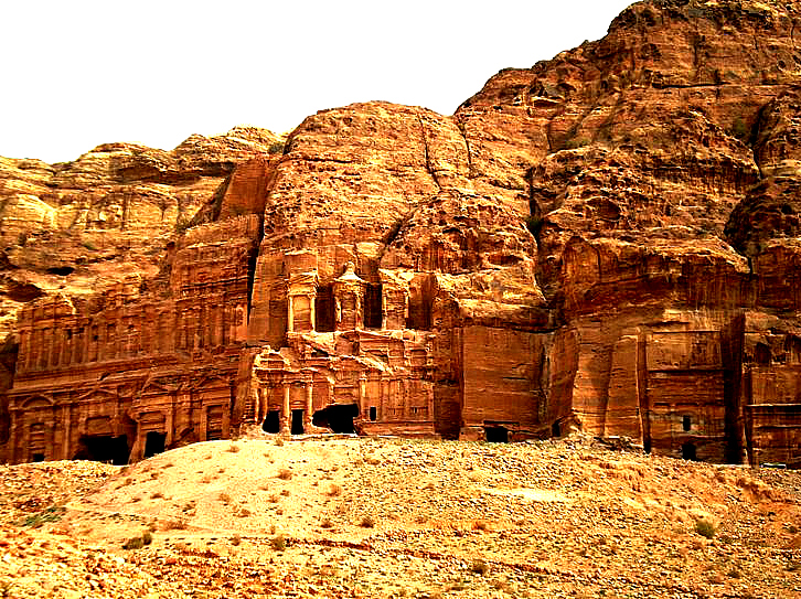
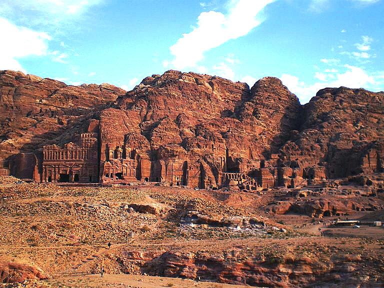

Tombs carved into the mountainside at the Wall Of Kings.
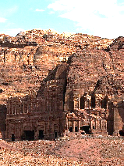
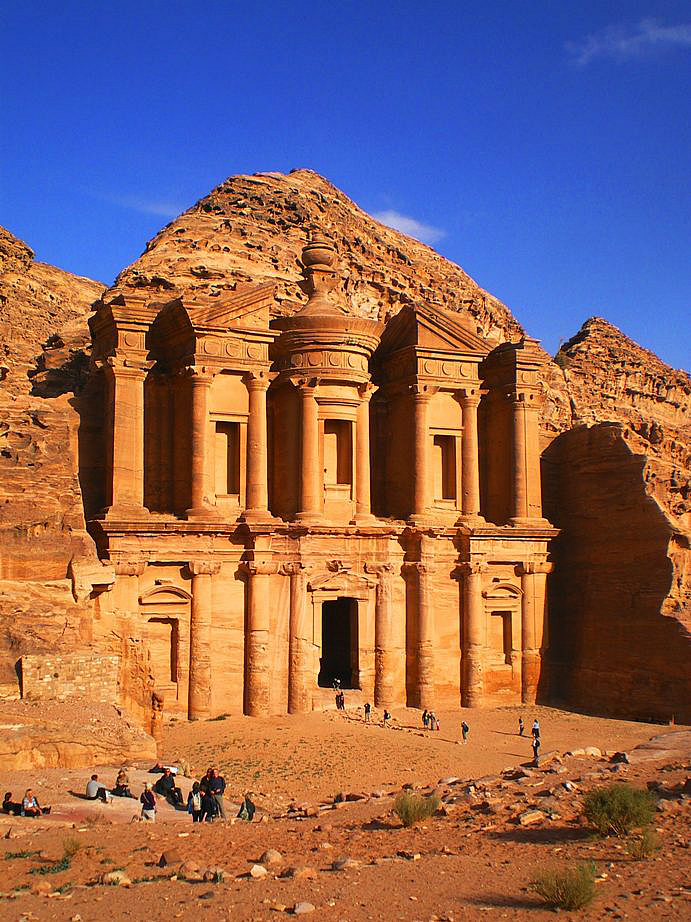
The Monastary (above right) about an hour climb from the valley floor at the other end from the Treasury, and equally misnamed. It was probably a temple, dating from about the 1st century BC by the Nabateans, a civilization that emerged in southern Jordan from a nomadic tribe that migrated gradually from Arabia during the sixth century BC. They settled in a number of places in southern Jordan, Palestine and in northern Arabia. Their capital city was Petra and for nomads they demonstrated quite a knack for rock carving. The modern town of Wadi Musa (Valley of Moses) can be seen in the distance from the climb to the Monastary. The walk into Petra from Wadi Musa doesn't seem as far as it looks - your mind is occupied with the continual 'wow' moments.
Petra to Amman
Bucket List Rating
Crusader castles
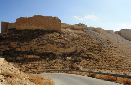
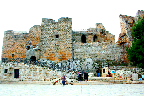
Montreal a Crusader castle (Shoubak in Arabic) is perched on the side of a rocky, conical mountain, looking out over fruit trees on steep hillsides. Built in 1115 by Baldwin I of Jerusalem during his expedition to the area where he captured Aqaba. Originally called 'Krak de Montreal' or 'Mons Regalis' little remains of the original Crusader fortifications.
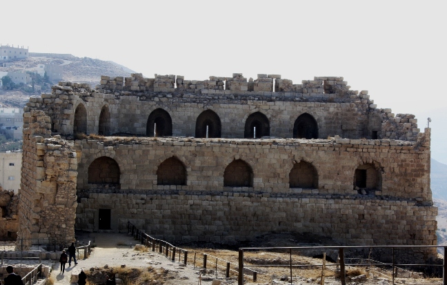
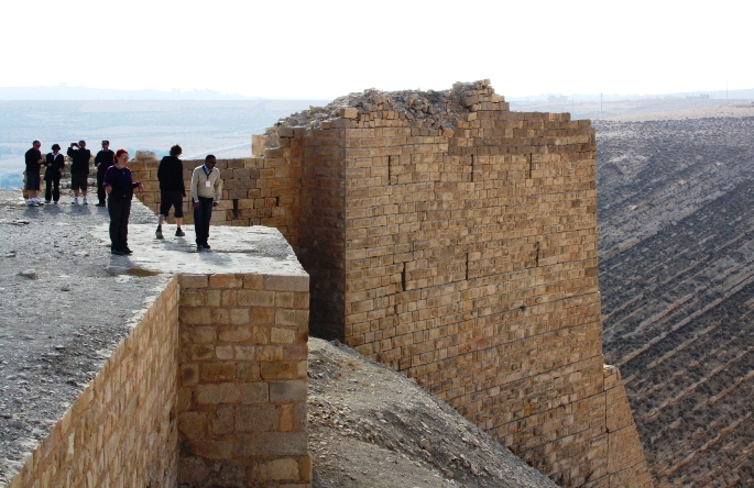
Kerak Castle a large crusader castle located above the town of Kerak, began in the 1140s. The Crusaders called it Crac des Moabites or "Karak in Moab".
The road to Madaba from Kerak winds down one side and up to a plateau on the other. A good quality road but not overly equipped with barriers to stop mistakes ending up in a long, tumbling plunge to a horrible end. The river flows into the Dead Sea immediately to the west.
Madaba
Best known for its Byzantine-era mosaics including the Map of Madaba at the Greek Orthodox Church of St George displaying the major cities and features in the Holy Land. Jerusalem, apparently visible on a good day from the nearby Mt Nebo is placed in the centre of the map.
Abandoned in the 8th century due to earthquakes, Madaba was re-populated in the late 1800s by Christian families from Kerak and boasts of the religious tolerance of its Muslim, Catholic and Greek Orthodox citizens. The Roman Emperor Diocletion, he of the Palace at Split in Croatia stuck with the traditional religious practice of persecuting believers in alternative invisible friends by murdering early Christians at Madabar.
The Dead Sea
Not particulalry scenic, it's a Must See if only to test the famous buoyancy of the water and to brag that you've been to the earth's lowest land elevation. While its elevation isn't apparent, it sure is buoyant with people bobbing around like corks as were a few discarded cigarette butts, band-aids and some other undetermined horrors.
The minerals in the water and the black mud are supposedly good for you - but it needs to be thoroughly washed off. That stuff clings to skin in a scratchy, greasy, unpleasant coating and it takes several rinses of any clothing to be got rid of.
Amman
Bucket List Rating
Not the biggest, not the oldest, not stuffed with the most famous antiquities - but it works. A place to get the feel of the Middle East without the accompanying squalor, overcrowding, noise and constant attempts to extract your money.

The original Philadelphia, so named by the Greeks in the 3rd century BC. Subsequently Roman and Byzantine it was re-named Amman after the Islamic conquests when it became a part of the Muslim empire until the Ottomans were forced out by the Allies in WW1 with the help of the Hashimites who formed a monarchy that continues.
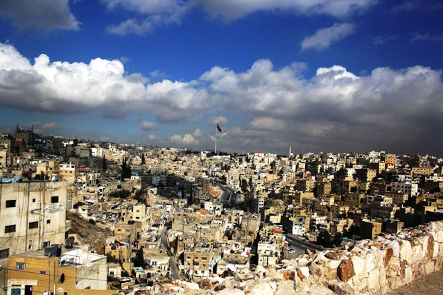
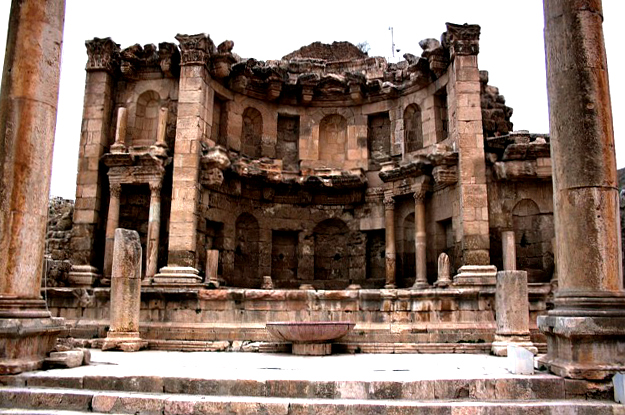
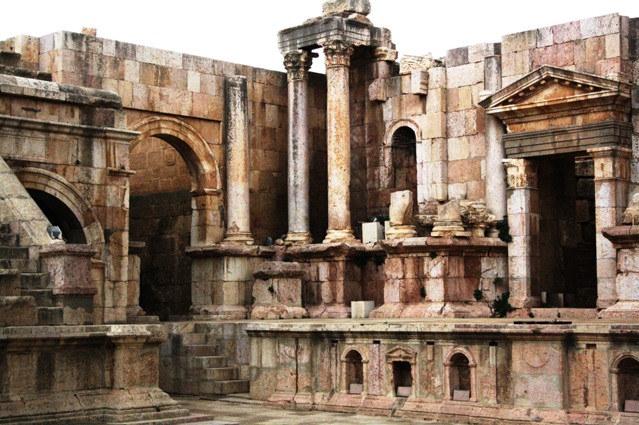
A view of the traditional downtown Amman from the Citadel. The view from the Citadel includes that of a large Roman amphitheatre at the foot of the hill.
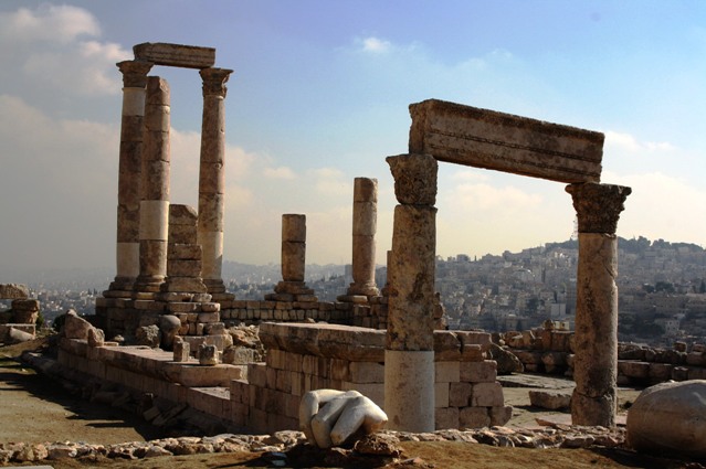
Temple of Hercules at the Citadel. The Citadel includes the ruins of a Byzantine basilica and Umayyad Palace complex and the Jordan Archaeological Museum whose collection includes
some of the Dead Sea Scrolls. The Israelis apparently have the others.
Jarash
Bucket List Rating
What did the Romans ever do for us?
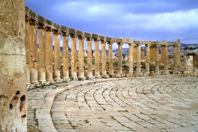
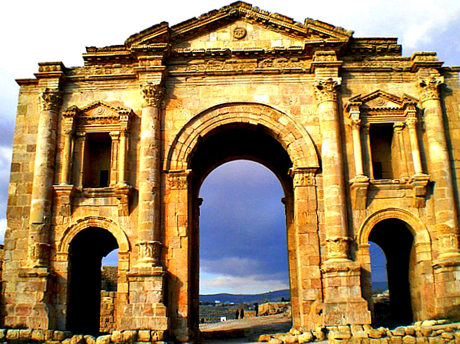
Jarash / Jerash reached its peak under the Romans during the 3rd century AD. By the time the Crusaders passed through the area the city was uninhabited. A strong earthquake in 749 AD destroyed large parts of it, subsequent earthquakes added to its destruction. What was left was rediscovered in 1806 and despite is ruined state it is an impressive collection of partly restored Greco-Roman collonades, amphitheatres, columns, hippodrome, temples and still buried ruins spread over a huge site.
About 10 kilometres from Jarash, beside the hilly town of Ajloun on pine covered mountains, Ajloun Castle (Qal'at ar-Rabad) was built in 1184 by a nephew of Saladin. It protected the communication routes between south Jordan and Syria, and was one of a chain of forts, which lit beacons at night to pass signals from the Euphrates as far as Cairo. Its hilltop position provides a panoramic view of the Jordan Valley.
Travel notes:
- Jordan is the most functional and non-confronting of the 3 countries on the tour. Jordan has a pro-West strategic orientation, commitment to peace with Israel, cooperation on counterterrorism and security and a moderate, nonideological and revolution-averse political culture . A highly recommended place to visit.
- A feeling of space - in the countryside and in the cities of Aqaba and Amman. Amman, while busy, didn't impose the unruliness and claustrophobia of Cairo.
- An old Bedouin guy who hosted tourists who dropped into his camp in a ravine in the desert at Wadi Rum asked Ossama if I was a general in the army. Top that for style. Not a major, or a colonel, an Arab general!
- Walk down to Petra, don't take one of the horse-drawn buggies. The poor, under-fed looking horses get thrashed up and down the road into the site and they all looked skinny and mistreated.
- Mariam Hotel, Madaba - half smoked packets of cigarettes and unused (thankfully) condoms in the room. The cigarettes came in handy.
- Bus ride from Madaba to the Dead Sea - Ibrahim slowed down and alerted us to a weird phenomenon he'd experienced before on the stretch of upcoming road. We could swear we were going slowly backwards without experiencing any physical change of direction, while the speedo clearly showed we were moving forwards. A strange optical illusion.
- Palatial, hotel-sized residences on the shores of the Dead Sea - owned, we were told, by Russian mafiosi.
- Jordan may be cleaner than Egypt and Syria but plastic bags still festooned fences and bushes everywhere in the countryside and in some towns the gutter was an obvious dumping ground for garbage.
- Aqaba is on Jordan's only coastline - 25 kilometres 'long'. It sits right on the border with Israel which we've never been to, but we've seen it as close up as you can without actually stepping on it.